maunabo faro

Maunabo, Puerto Rico

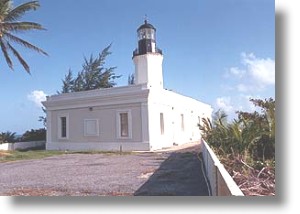
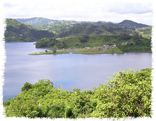
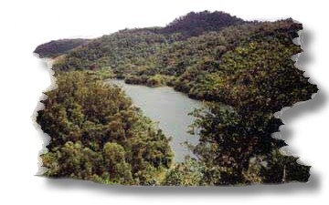
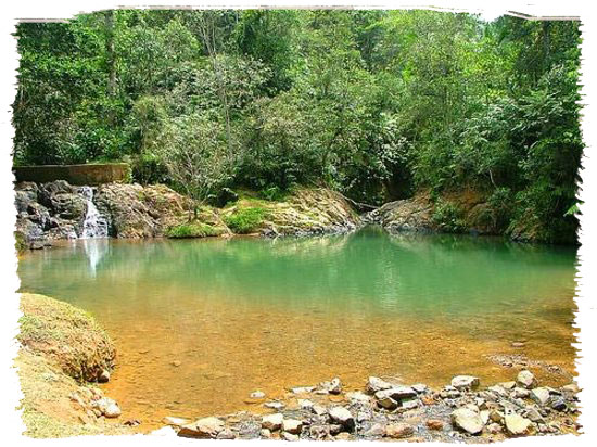
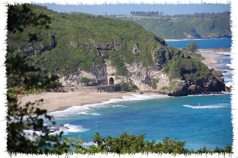
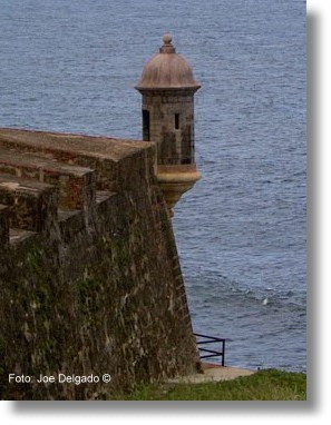
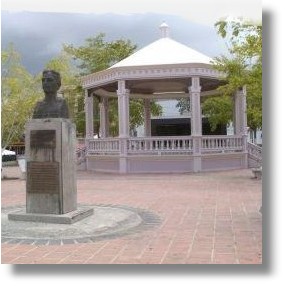
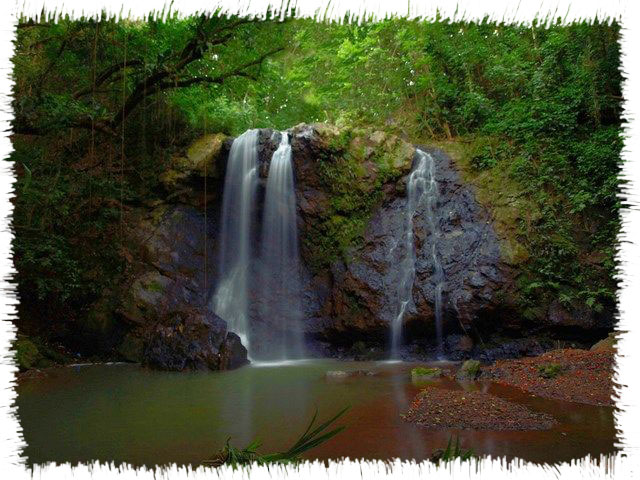
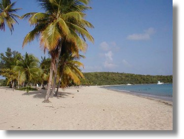
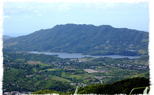
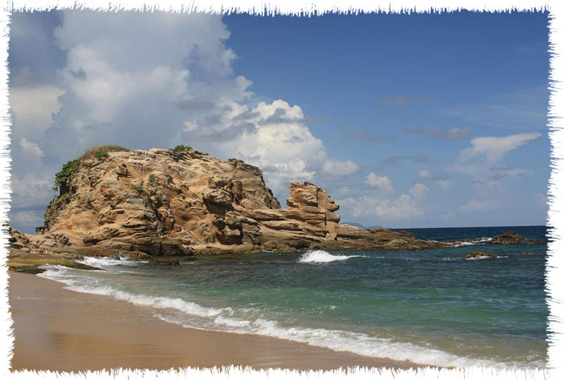
Maunabo, Puerto Rico The Calm City Maunabo (mou-NAH-bo) is known as the “land crab town”, “the town of the land crab eaters”, and “the calm city”. The patron saint is Saint Isidore the Farmer, whose festival is celebrated on May 15. Maunabo is located on the southeast coast, southeast corner of Puerto Rico. It is bordered on the north and northeast by Yabucoa, on the southeast by Patillas, and on the east south east by the Caribbean Sea. There are three regions in the municipality: the Maunabo valley in the south central area, the semiarid hills to the south, and the mountainous region to the east. The town is...

mayaguez estatua

Mayagüez, Puerto Rico

Mayagüez, Puerto Rico Sultan of the West Mayagüez (mah-yah-GWES) is known as “the Sultaness of the West,” because, according to legend, there was an extraordinarily beautiful woman of Arab features with whom everyone fell in love. It has also been called the “the city of pure waters”, “the birthplace of Eugenio María de Hostos,” the “jelly roll city,” “the city of the Indios (a baseball team), and “the mango town”. The patron of the city is Our Lady of Candlemas. This municipality is located on the west coast of Puerto Rico. It is bordered on the north by Añasco and Las Marías; Cabo Rojo, Hormigueros and San Germán on...

moca flor

Moca, Puerto Rico

Moca, Puerto Rico The Mundillo Lace Capital Moca is known as the “Capital of Mundillo Lace” and the “Town of the Vampires”. The patron saint is Nuestra Señora de la Monserrate. Moca is bordered on the east by the municipality of San Sebastián, on the west by Aguada, on the north by Isabela and Aguadilla and on the south by Añasco. Geographically, it is part of the sub-region called the western coastal valleys. This zone is characterized by very fertile alluvial soils, with abundant rain from May to November and a dry season that prevails from December to March. Agricultural products from Moca include plantains, bananas, pigeon peas, yautia,...

morovis cueva

Morovis, Puerto Rico

Morovis, Puerto Rico The Island Except Morovis Morovis (mo-RO-vis) is known as the Island Except Morovi. The phrase used is originated in a cholera epidemic that devastated Puerto Rico in 1853. Historical records show that Morovis was the only municipality where no cases were reported, and every time the topic was mentioned people would say “All of the island, except Morovis”. Our Lady of Mount Carmel is the patron saint, and the festival in her honor is held in July. Morovis is located in the northern part of Puerto Rico. The municipality is located in the humid northern hills, and the northernmost part of the territory is located in...

naguabo plaza

Naguabo, Puerto Rico

Naguabo, Puerto Rico Birthplace of Great Artists Naguabo (nah-GWAH-bo) is known as the “Birthplace of Great Artists”, “land crab town”, “the town of the land crab eaters”, and “the quiet town”. The patron saint`s festival is held in honor of Our Lady of the Rosary around October 7 of each year. Homage is also given to Our Lady of Mount Carmel, the patroness of fishermen, on July 17, on the coasts of Naguabo. Naguabo is located on the east coast and east coast of Puerto Rico. It is bordered on the north by Río Grande and Ceiba, by Humacao and the Vieques passage on the south, Ceiba and the...

naranjito lago

Naranjito, Puerto Rico

Naranjito, Puerto Rico The Town of Colors Naranjito (nah-rahn-HEE-to) is known as “The Town of Colors” and the “Blackbird Town.” The patron saint’s festival is dedicated to Saint Michael the Archangel, and is held around September 29. The town also celebrates the 13th of June in honor of Saint Anthony of Padua. Naranjito is in the central eastern region of Puerto Rico. Naranjito is one of the municipalities in the northern hills region. It is bordered on the north by Toa Alta, on the south by Barranquitas and Comerío, on the east by Bayamón, and on the west by Corozal. This town has traditionally grown coffee, tobacco, and produce,...

orocovis matrullas

Orocovis, Puerto Rico

Orocovis, Puerto Rico Heart of Puerto Rico Orocovis (o-ro-KO-vis) is known as the “Heart of Puerto Rico” and the “geographic center of Puerto Rico” because it is located precisely in the center of the island. The patron saint is San Juan Bautista. Orocovis is bordered on the north by the municipalities of Ciales, Morovis and Corozal, on the south by Juana Díaz, Villalba and Coamo, on the east by the municipalities of Barranquitas and Corozal and on the west by Ciales. Geographically, the municipality is part of the region known as the Cayey Range in the central mountain range, which is a mountainous zone. The municipality’s highest elevations are...

patillas charco azul

Patillas, Puerto Rico

Patillas, Puerto Rico Emerald of the South Patillas (pah-TEE-yahs) is known as “The Emerald of the South” and “the Melons”. The patron saint is Holy Christ the Healer and the saint’s festival is held in August. Attractions of the town include beaches, forests, and Patillas Lake. The coastal waters and the lake are used by many for recreational fishing. Patillas is located on the southeast coast of the island. It is bordered on the north by Cayey and San Lorenzo and the south by the Caribbean Sea, on the east by Yabucoa and Maunabo, on the west by Arroyo, and on the northeast by Guayama. Although a significant part...

penuela _flamboyan

Peñuelas, Puerto Rico

Peñuelas, Puerto Rico Valley of the Flame Trees Peñuelas (PAIN-wai-lahs) is known as “The Valley of the Flamboyan Trees” and “The capital of the Güiro”. The patron saint is Holy Christ the Healer and the festivities held in his honor are held in September. There are also musical festivals during the summer months. The town is located on the south coast of the Island and is bordered by Adjuntas to the north, the Caribbean Sea to the south, Ponce to the east, and Guayanilla to the west. It is located on the southern coastal plains, but the northern part of its territory is located in the central mountain range....

ponce bombas

Ponce, Puerto Rico

Ponce, Puerto Rico Pearl of the South Ponce (PON-sai) is known as the “Pearl of the South,” the “Noble City,” “The Lions,” and the “Genip City”. The patroness of Ponce is Our Lady of Guadeloupe. The municipality is located on the south coast of Puerto Rico. Is bordered on the north by Utuado and Jayuya, on the northwest by Adjuntas, on the south by the Caribbean Sea, on the east by Juana Díaz, and on the west by Peñuelas. The municipal territory reaches the central mountain range to the north and the Caribbean Sea to the south. The city is also known for landmarks such as the Old Ponce...

quebradilla guajataca

Quebradillas, Puerto Rico

Quebradillas, Puerto Rico The Pirate’s Hideout Quebradillas (ke-brah-DEE-yahs) is known as “the pirate’s hideout” or “the pirate city,” “the cooperative city,” and “Guajataca corner”. The municipality is located on the north coast of the island. The patron saint’s day festival is dedicated to Saint Raphael the Archangel, and is celebrated on the days around the Saint’s Day, October 24. Tourist attractions include the El Guajataca Hotel, a theme park, and Guajataca Lake, where there is sports fishing. Quebradillas is located on the north coast of the island. The town is bordered on the north by the Atlantic Ocean, on the south by Guajataca Lake (San Sebastián), on the east...

rincon faro

Rincón, Puerto Rico

Rincón, Puerto Rico Town of Beautiful Sunsets Rincón (ring-KON) is known as the “Town of the Beautiful Sunsets” and “Surfing Town,” its residents are called “The Surfers”. Its patron saint is Santa Rosa de Lima. Rincón is visited by thousands of tourists each year. Since the celebration of the World Surfing Championship almost twenty years go, Rincón’s six beaches have turned into the winter mecca for people who practice surfing. Whales in danger of extinction can be observed in the area during the months of winter. Rincón is located on the extreme western point of the island. Rincón is bordered on the north by the municipality of Aguada and...

riogrande yunque

Río Grande, Puerto Rico

Río Grande, Puerto Rico El Yunque City Río Grande (REE-o GRAHN-de) is known as the “City of El Yunque”. The mountainous zone is part of the Caribbean National Forest, which is part of the Luquillo mountain range. The majority of this forest is located within the municipality of Río Grande. The municipality’s patron saint is the Virgen de Nuestra Señora del Carmen. Río Grande is bordered on the north by the Atlantic Ocean, on the east by the municipalities of Luquillo and Ceiba, on the west by Loíza, and on the south by Naguabo and Las Piedras. Geographically, it is part of the region called the northern coastal plains....

riopiedras universidad

Río Piedras, Puerto Rico

Río Piedras, Puerto Rico University City Río Piedras has left indelible marks on the modern history of Puerto Rico. This former municipality, now a part of San Juan, has played an important role in the development of the island’s transportation, education and commerce. The growth of Río Piedras is related to its strategic position. Because of its nearness to the capital, the region became the main supplier of food and potable water for San Juan. However, the development of the urban center was slow, as the first settlers in the region were plantation and ranch owners who had no interest or need to establish an urban nucleus. The economic,...

sabanagrande palma

Sabana Grande, Puerto Rico

Sabana Grande, Puerto Rico Town of Prodigies Sabana Grande (sah-BAH-nah GRAHN-de) is known as the “Town of Prodigies”, the “Town of the Virgen del Rosario del Pozo,” the “City of the Petate” and the “Town of the Petate Makers”. The petate is a mat made from a type of palm (Thrinax morrisii) that grows in the area. This palm weave had diverse uses, among them: sleeping mats, and mats to dry coffee and other grains. The patron saint of the municipality is San Isidro Labrador. The municipality is bordered on the north by the municipality of Maricao, on the south by Guánica, on the west by San Germán and...

salinas casagrande

Salinas, Puerto Rico

Salinas, Puerto Rico Town of the Islander Dip Salinas (sah-LEE-nahs) is known as “The town of the Island Mojo” and its residents are called the Marlins. “Mojo” is a sauce that is used to marinate fried fish and is made from a base of tomato sauce, oil, garlic, bay leaves and onion. The patron saint of the municipality is the Virgin of Monserrate. Salinas is located on the southern coast of Puerto Rico. It is bordered on the north by the municipalities of Coamo, Aibonito and Cayey, on the south by the Caribbean Sea, on the west by the municipalities of Coamo and Santa Isabel and on the east...

sangerman coeli

San Germán, Puerto Rico

San Germán, Puerto Rico The City of Hills San Germán (sahn her-MAHN) is known as the “City of the Hills”, the “City of the Swallows”, the “Founding City”, the “Cradle of Puerto Rican Basketball” and the “Pilgrim City.” The patron saint is San Germán de Auxerre and residents are called sangermeños. San Germán is bordered on the north by the municipalities of Mayagüez and Maricao, on the east by the municipality of Sabana Grande, on the west by Hormigueros and Cabo Rojo and on the south by the municipality of Lajas. Geographically, it is part of the region called the western plains or coastal valleys. Its land is alluvial...

San Juan, Puerto Rico

San Juan, Puerto Rico

San Juan, Puerto Rico The Fortified City San Juan (sahn HWAHN) is known as “the walled city,” “the capital city”, “the paved city,” and “colonial city”. The residents are known as capitalinos and senadores, the latter is an allusion to their baseball team. The city of San Juan is located on the north coast of Puerto Rico and it is the capital of island. The colonial part of the city is known as a historic and cultural center, in which the military architecture built from the 16th to the 18th century is its outstanding feature. The old port is also an important port of call for ships that sail...

sanlorenzo chayanne

San Lorenzo, Puerto Rico

San Lorenzo, Puerto Rico The Town of the Samaritans San Lorenzo (san lo-REN-zo) is known as the “Town of Samaritans” and the “Samaritan City”. The patron saints of the town are Nuestra Señora de las Mercedes and San Lorenzo, for whom the town is named. San Lorenzo is located in the eastern part of Puerto Rico. It is bordered on the north by the municipality of Gurabo, on the east by Juncos and Las Piedras, on the west by Caguas and on the south by Patillas and Yabucoa. This municipality is part of the geographic region called the Caguas interior valley, although in the southeast part there are some...

san sebastian

San Sebastián, Puerto Rico

San Sebastián, Puerto Rico St. Sebastián Del Pepino San Sebastián (sahn se-bahs-tee-AHN) most widely nicknamed “San Sebastián del Pepino”, are also called “the hammock town”. The townspeople are known as pepinianos and patrulleros (patrollers). The patron saint is Saint Sebastian, the Martyr. San Sebastián is located in the central mountain range of Puerto Rico. Is bordered on the north by Isabela and Quebradillas, on the east by Lares, on the south by Las Marías, and on the west by Moca and Añasco. The town lies in the geographical region of the humid northern hills. The mountainous topography includes elevations between 100 and 300 meters (330 to 985 feet) above...

santa isabel

Santa Isabel, Puerto Rico

Santa Isabel, Puerto Rico Land of Champions Santa Isabel (SAHN-tah ee-sah-BEL) is known as the “Land of Champions” and the “City of Colts.” The patron saint is Santiago Apóstol. Santa Isabel is located on the south coast of Puerto Rico in the region known as the southern coastal plain. Is bordered on the north by the municipality of Coamo, on the south by the Caribbean Sea, on the east by the municipality of Salinas and on the west by Juana Díaz. The Santa Isabel beach, the Petrona and Aguila points, Jauca Bay and Rincón Bay are located in Santa Isabel and Salinas. Off of Petrona Point are the keys...

Cascada Yolanda

Toa Alta, Puerto Rico

Toa Alta, Puerto Rico City of the Toa Toa Alta (TO-ah AHL-tah) is known as the “Toa City,” the “Cradle of Poets” and the “City of Josco.” The Toa part of the name comes from the name the Tainos gave to La Plata River. The word means “mother” in the Taino language and was frequently spelled “Thoa.” The patron saints of the municipality are San Fernando Rey and Nuestra Señora de la Concepción. The municipality is bordered on the north by the municipalities of Dorado and Toa Baja, on the east by the municipality of Bayamón, on the south by Naranjito and on the west by Vega Alta and...

Leprosario - Isla de Cabras

Toa Baja, Puerto Rico

Toa Baja, Puerto Rico Valleys of the Toa City Toa Baja (TO-ah BAH-hah) is known as the “City of the Toa Valleys”, the “Underwater City” and the “People of the Plains”. The patron saint is San Pedro Apóstol. Toa Baja is bordered on the north by the Atlantic ocean, on the west by the municipality of Dorado, on the south by Toa Alta and on the east by the municipalities of Cataño and Bayamón. Geographically, it is part of the region called the northern coastal plain. Its land is very fertile. The municipality’s hydrological system consists of La Plata (Toa) River, the longest river on the island, and the...

trujilloalto represa

Trujillo Alto, Puerto Rico

Trujillo Alto, Puerto Rico Laid Back Town Trujillo Alto (troo-HEE-yo AHL-to) is known as the “City of Springs,” the “Town of Eight Streets,” the “City in the Country” and the “Town of Learners”. The municipality of Trujillo Alto is located in the northern part of Puerto Rico. It is bordered by San Juan on the north and west, by Caguas and Gurabo on the south and by Carolina on the east. It is part of the northern coastal plain and the karst zone. The vegetation is typical of tropical humid forests. Trujillo Alto is mostly hilly and the region is humid. Previously, the municipality’s lands were dedicated mainly to...

utuado embarcadero

Utuado, Puerto Rico

Utuado, Puerto Rico City of the Viví Utuado (oo-too-AH-do) is known as the “City of the Viví” and the town of “The Highlanders”. The municipality’s patron saint festival is held in late September in honor of San Miguel Arcángel. Other cultural festivals include the Otoao festival in December and the Angeles neighborhood festival in March. Utuado is located in the mountainous central part of the island. It is bordered to the north by the municipalities of Hatillo and Arecibo, to the south by Adjuntas, Ponce and Jayuya, to the east by Ciales and Jayuya and to the west by Lares. Geographically, it is part of the central mountainous interior...

Playa Cerro Gordo, Vega Alta

Vega Alta, Puerto Rico

Vega Alta, Puerto Rico Town of Squaters Vega Alta (VAI-gah AHL-tah) is known as the “Squatters Town” and its residents are called the “Pottery Makers.” According to popular history, the “Squatters Town” nickname comes from the habit of sugar cane workers to resting in a squatting position while waiting for the train that carried the cane, because the station did not have any seats. Vega Alta is located on the north coast of Puerto Rico. It is bordered on the north by the Atlantic Ocean, on the south by Morovis and Corozal, on the east by Dorado and Toa Alta and on the west by Vega Baja. The municipality...

vega baja

Vega Baja, Puerto Rico

Vega Baja, Puerto Rico City of “Syrup” Vega Baja (VAI-gah BAH-hah) is known as the “City of Melao Melao,” which refers to its past of growing sugar cane. It is also known as the “City of Orange Groves” because oranges were the most commonly grown fruit in the town. The patron saint is Nuestra Señora del Rosario. The municipality is located in the central part of the north coast of Puerto Rico. Is bordered on the north by the Atlantic Ocean, on the south by Morovis, on the west by Manatí and on the east by Vega Alta. It is located in the northern coastal plain and the karst...

vieques sunbay

Vieques, Puerto Rico

Vieques, Puerto Rico Baby Island Vieques (vee-AI-kais), baptized the “Baby Island”, or “Little Girl Island”, by poet Luis Llorens Torres, is located 10 kilometers (6 miles) southeast of Puerto Rico. The patron saint festival is held in July in honor of the Virgen del Carmen, the patron saint of Vieques. Vieques is currently in the process of reorienting its economy due to the transfer of lands formerly occupied by the United States Navy to the government of Puerto Rico in May of 2003. The eastern part of the island is now under the control of the United States Fish and Wildlife Service while various parts of the western zone...

villalba

Villalba, Puerto Rico

Villalba, Puerto Rico City of the Advancers Villalba (vee-YAHL-bah) is known as “Cuidad de los Avancinos”, the “City of Cooperatives” and the “City of Pigeon Peas.” Its residents are called Villalbeños. The patron saint is Nuestra Señora del Carmen. The municipality is known as the City of Advances because the first hydroelectric plant in Puerto Rico was built there in 1929. This event made Villalba the first town on the island to have electricity. Today, the plant is called Toro Negro and generates electricity for all of Puerto Rico. Villalba is bordered on the north by the municipality of Orocovis, on the east by Coamo, and on the south...

Yabucoa, Puerto Rico

Yabucoa, Puerto Rico City of Sugar Yabucoa (yah-boo-KO-ah) is known as the “City of Sugar,” “Town of the Yuca,” and its residents, Yabucoeños, are nicknamed “milky drinkers”. The name Yabucoa comes from the Taino chief Guaroca, which means “place or site with water”, according to some scholars. Others say the name refers to “place of cassava”. Yabucoa is located in the southeast of Puerto Rico. It is bordered on the north by San Lorenzo, Las Piedras and Humacao, on the west by San Lorenzo and Patillas, on the south by Maunabo and the Caribbean Sea; and on the east by the Caribbean Sea. Geographically, it is part of the...

yauco cafe

Yauco, Puerto Rico

Yauco, Puerto Rico Land of Coffee Yauco (YOU-ko) is known as the “Coffee Town,” the “Taino Capital,” and the “Town of Corsicans.” Its patron saint is the Virgen del Santísimo Rosario. Its name comes from the Taino word Coayú or Coayuco, which was used to identify the region and is related etymologically to the word yuca or cassava. Yauco is bordered on the north by the municipalities of Maricao, Lares and Adjuntas, on the east by Guayanilla, on the west by Guánica and Sabana Grande and on the south by the Caribbean Sea. The municipality is part of the southern coastal plain. Although the northern zone of the municipality...

You May Also Like