Guánica, Puerto Rico
Friendship City
Guánica (GWAH-nee-kah) is known as “El Pueblo de la Amistad,” “Los Jueyeros,” “El Pueblo de las Doce Calles,”and “La Puerta de la Cultura” (Friendship Town, The Crabbers, Town of the Twelve Streets, Portal to Culture). The town’s patron saint is Saint James the Apostle, whose festival is celebrated on July 25. Other important celebrations are the Fish Festival held every year in April, and the annual commemoration on August 12 of the day when Spanish conquistador Juan Ponce de León landed at Guánica’s bay.
Guánica is situated on Puerto Rico’s southwestern coast, and is bounded by the Caribbean Sea to the south and by the towns of Sabana Grande to the north, Yauco to the east, and Lajas to the west.
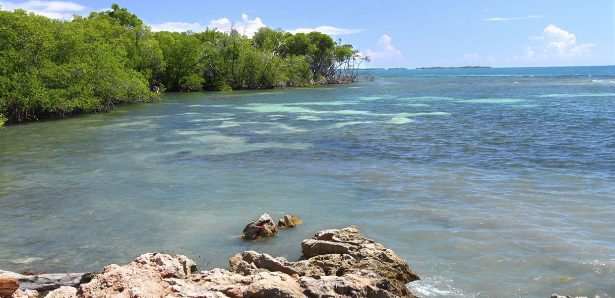
The coastal municipality offers its visitors a variety of beach destinations, such as: Ballena bay and Gilligan’s island — located at the eastern end of the municipality — and Pardas, Manglillo and Playa Santa located at the west.
Guanica has a number of natural attractions such as its beaches: Caña Gorda, Ballena, Santa, Jaboncillo, and Las Pardas, to name a few and the Guánica State Forest (a xerophytic, or dry, forest reserve). This forest is extraordinarily well preserved, and has been the subject of much study. Because of its scientific importance, it was designated as an international biosphere reserve in 1981 and a Forest Reserve in 1985.
There are also archeological sites, as well as historical monuments such as the Caprón fortress and its watchtower, an observation post used during the Spanish colonization situated on Cerro Caprón (Caprón Hill).
Guanica’s workforce is employed primarily in construction, retail sales, and the hospitality industry. The town’s economy, however, also centers on raising produce and cattle and on the extraction of salt from the sea. Other industries, including manufacturing (food and food products; electronic equipment; metal, rubber, and plastic goods), have also contributed to the local economy.
Foundation:
Guanica was founded in 1914. In 1906 started eight years of intense civic fight in which the "Guaniqueños Segreguistas" (Guanica Segregationists) knocked on all doors and took their case to all the newspaper columns of the country, convincing the delegate to the Camera (Governing Body), Don Carlos A. Del Rosario, to initiate a project endorsed both by Union Delegates and by Republican Delegates who composed the Camera in those days. The project was approved by Governor Yaguer, segregating Guanica from Yauco making it a municipality March 13, 1914.
The origin of the name of "Guanica" comes from the agglutination of three indigenous roots: Guá, "he aquí" (here is); ni, "agua" (water); and ca, "lugar" (place). Therefore meaning, "he aquí un lugar de agua" (here is a place of water).
Guanica is a young municipality, but its history goes back to the time of the colonization. The historians say that when Juan Ponce de León arrived to the Island in 1508 disembarking at the Bay of Guanica, Agüeybaná (the main Chief of the island) resided in this territory. At that time Guanica represented the indigenous capital of the Island.
Guanica was also the landing place of North American troops in 1898.
Localización:
 Located on the southern coast, it is bordered by: Sabana Grande to the north, the Caribbean Sea to the south, Lajas to the west, and Yauco to the east.
Area:
94.9 sq km / 36.5 sq mi
Population:
21,888 (census 2000)
Population Density:
230.6 per sq km / 599.6 per sq mi
People are known as:
Guaniqueños
Guánica is also known as:
Pueblo de la Amistad (Town Of Friendship)
El Pueblo de las Doce Calles (The Town Of The Twelve Streets)
Puerta de la Cultura (The Portal Of Culture)
Wards: Guanica, Puerto Rico
| Census 2000: Population by Wards - Guánica | Habitants |
| Arena | 84 |
| Caño | 1,965 |
| Carenero | 2,862 |
| Ciénaga | 2,376 |
| Ensenada | 2,184 |
| Guánica Pueblo | 4,699 |
| Montalva | 3,148 |
| Susúa Baja | 4,570 |
| Total | 21,888 |
Información: Negociado del Censo de los EE.UU. Censo 2000
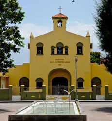
Patron:
San Antonio Abad
San Antonio Abad Parish
Apartado 804 Guánica, P.R. 00653
(787) 821-2147
Topography:
The territory is almost level, except for small elevations: the Lajara hills (in Montalva), which is the highest one, with 178 meters (584 feet), the Abra (in Ensenada), Seboruco (in Carenero), and El Peñón (in Ciénaga). The Montalva , Las Pardas and La Brea hills, all in the Montalva ward, are below 100 meters (328 feet) of height.
Hydrography:
The Loco River, which rises in Yauco and flows into Guanica by the northeast and ends at the Guanica Bay. Also forming part of this systems is the Guanica Lagoon.
Economy:
Manufacture (apparel) and tourism.
Average Salary:
$250.94 weekly (1998)
Flag:
 The five waves, blue and yellow represent the Guanica Bay, a fragment of the Official Shield of Guanica. It symbolizes the indigenous territory of Guaynía, name doubtlessly related to Guanica and that Fernando Fernandez de Oviedo, in his General History of the Indians, says that in this region several rivers of gold ran. The name of Tavara or Tábora recalls, the maternal last name of Don Cristóbal de Sotomayor given to the town because of its proximity to the Guanica Bay.
Coat Of Arms:
 Shield divided in four quarters. In the superior right side, it has a "bohio" (hut) under a crown that represents Cacique Agüeybaná, whose yucayeque (indian territory) was in this region. In the superior left quarter, a lion representing Juan Ponce de León.
The checkered strips over a silver-plated background in the inferior right side represent the shields of Don Cristóbal de Sotomayor, founder of the town of Tavara, the actual location of Guanica. The waved stripes represent the bay of this town. The branches surrounding the shield represent the sugar cane industry that was very important in this region.
Events:
- Fish Festival – April
- Patron Saint’s Festival – July
- July 25th Parade
- Juan Ponce de León Celebration
Places To Visit:
- Guanica State Forest – Subtropical dry (xerophytic) forest. Designated as a Forest Reserve and as an International Biosphere Reserve.
- Guanica Sugar Mill – Located in barrio Ensenada. Was one of the largest sugar mills on the island.
- Guanica Nautical School
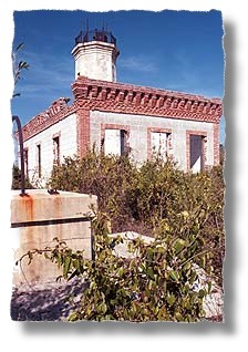
- Guanica Lighthouse – Built in 1892. Used as a hospital during the U.S. invasion.
- Caprón Fortress – Located atop the hill of the same name; provides a panoramic view of the entire area.
- Hacienda Guanica
- Hacienda Igualdad
- Hacienda Santa Rita – Now Convent of the Sisters of Fatima
- Gilligan’s Island
- Malecón de Guanica
- Guanica Monument to Veterans of the Spanish-American War – Located on the spot where the U.S. troops made landfall. Erected in 1938 and dedicated on July 25 of the same year, by Mayor Clemente J. Rodríguez Carlo, to the veterans of the war in 1898 between the United States and Spain.
- Punta de Brea
- Punta Jorobado
- Ballena [Whale] Bay Natural Reserve
Beaches:
- Paldas Beach
- Ballenas Beach
- Manglillo Beach
- Jaboncillo Beach
- Santa Beach
- Atolladora Beach
- Caña Gorda Beach
- Aroma Beach
Distinguished Citizens:
- Primitivo Anglada – Activist in obtaining Guanica’s municipal independence. First secretary of the Town Council.
- Rose Franco – First Puerto Rican woman to be named a chief warrant officer in the U.S. Marine Corps.
- Miguel A. Morciglio – Member of the House of Representatives for District 24 (1961-1964).
- Carmen Ramírez Vargas (Lolita Vargas) – Singer, actress, and educator.
- Rubén del Rosario – Educator, writer, and linguist.
- Víctor Sallaberry – First mayor elected by the people, in 1914.
- Pedro Santana Ronda – Writer, poet, and journalist. Was published in the weekly paper El Erizo.
- Domingo Suárez Cruz – Civic leader, political orator, and writer. Was keeper of the Guanica Lighthouse. The public library was named in his honor.
- María Heliodora Vargas – Educator and author of the poem “La bandera de los guaniqueños” [The Flag of the Guaniqueños].
- Pedro Juan Vargas Mercado – Journalist and historian.
- Pedro Vargas Rodríguez – Secretary of the Separation Committee that achieved the emancipation of the municipality. Poet, orator, musician, writer, and journalist. Founded El Fósforo (1908) and Brisas del Caribe (1915), the first newspapers in Guanica.
Public Schools sorted by educational levels.
San Germán Región
Guanica District
| Name | Level | Telephone | Address |
| AGRIPINA SEDA | Intermediate | (787) 821-2570 | PO Box 690 |
| ÁUREA QUILES CLAUDIO | High School | (787) 821-2800 | PO Box 494 |
| CEFERINO COLÓN LUCCA | Elementary | (787) 821-6066 | PO Box 1110 |
| ELSA E COUTO ANNONI | Elementary | (787) 821-3222 | PO Box 1037 |
| FRATERNIDAD | Elementary | (787) 821-3121 | PO Box 1045 |
| JOSÉ RODRÍGUEZ SOTO | Elementary | (787) 821-2310 | PO Box 691 |
| LUIS MUÑOZ RIVERA | Elementary | (787) 821-3121 | PO Box 327 |
| MAGUEYES II | Elementary | (787) 821-7000 | PO Box 1010 |
| MARÍA DEL ROSARIO CRUZ CLAUDIO | Elementary | (787) 821-7322 | PO Box 1110 |
| MARÍA L MC DOUGALL | Elementary | (787) 821-2490 | PO Box 599 |
| OLGA E COLÓN TORRES | Elementary | (787) 821-3160 | PO Box 1087 |
| TERESITA NAZARIO | Intermediate | (787) 821-2300 | PO Box 538 |
Hymn:
By José Luis Padilla (Cheliquin)
América es jardín del mundo;
Puerto Rico es el jardín de América,
América es jardín del mundo;
Puerto Rico es el jardín de América
Pero mis versos los dedico
a mi pueblito del alma
Guánica, Guánica
pueblo que es obra de Dios.
Su bahía de cristal,
sus valles verdes de caña;
adornando cual collar,
bordeando están sus montañas.
Guánica, Guánica
que es jardín de Puerto Rico;
Guánica, Guánica
pueblo que es obra de Dios.
Son sus playas, tan azul,
Playas gemelas del cielo;
Sus mujeres sasonáz...
con sabor dulce de caña.
Guánica, Guánica
que es jardín de Puerto Rico;
Guánica, Guánica
pueblo que es obra de Dios.
América es jardín del mundo;
Puerto Rico es el jardín de América,
Guánica, Guánica
es jardín de Puerto Rico.
Guánica, Guánica
pueblo que es obra de Dios.
Guánica, Guánica