Río Piedras, Puerto Rico
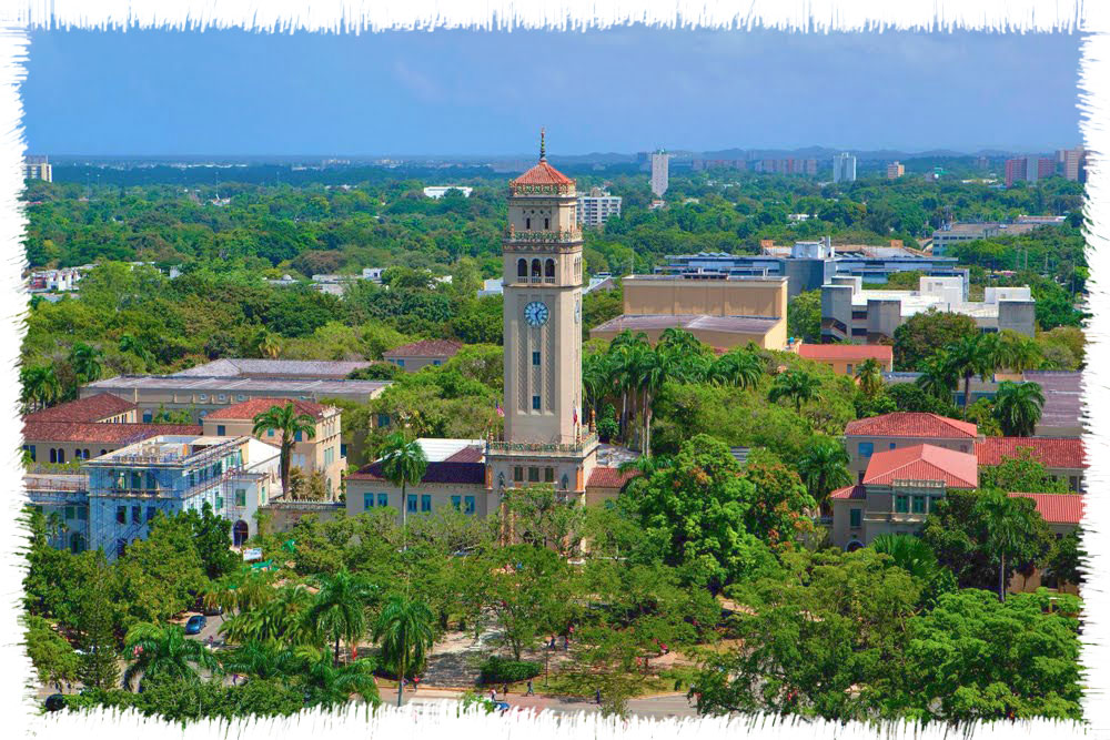
University City
Río Piedras has left indelible marks on the modern history of Puerto Rico. This former municipality, now a part of San Juan, has played an important role in the development of the island’s transportation, education and commerce.
The growth of Río Piedras is related to its strategic position. Because of its nearness to the capital, the region became the main supplier of food and potable water for San Juan. However, the development of the urban center was slow, as the first settlers in the region were plantation and ranch owners who had no interest or need to establish an urban nucleus.
The economic, demographic and territorial growth of the municipality of Río Piedras, as well as the exodus of San Juan residents, due to the scarcity of land in the capital, were some of the reasons that Río Piedras was annexed to the municipality of San Juan. Despite the opposition of the residents of Río Piedras, after the approval of Bill 177 by the House of Representatives, the former Villa del Roble, Río Piedras, was incorporated as a sector of the municipality of San Juan on July 1, 1951.
The first settlers dedicated themselves to the harvest of sugarcane, cotton, coffee, casabe and other fruits, but generally they were dedicated to cattle raising in order to supply the Capital’s need for beef. The Vannina Sugar Mill contributed to the economy with its sugar production.
In 1903 the University of Puerto Rico (UPR) was founded in the outskirts of the town of Río Piedras. It is known as “University City” because it is home of the biggest and oldest university institution of the Island. The construction of the first university of Puerto Rico, as well as its fresh water bodies and abundant farms called the attention of many causing the small town to grow.
Foundation:
What is known today as Río Piedras in the past had its origin as a settlement called El Roble along the shores of the Piedras river. Originally it was known as the Village or Villa del Roble. The official foundation took place in 1714 under the name of El Roble with the authorization of governor Juan de Rivera. The name derives from the Piedras river that crosses it.
In the 1832 Río Piedras was constituted by four wards: Roble (pueblo), Cupey, Caimito and Monacillos. In 1823 the municipal government made a request to governor Miguel de la Torre to aprove the purchase of land for the formation of an urban zone. The land was divided and granted to people who were interested in constructing homes. Such action brought as consequence the formation of streets and alleys, giving the appearance of an urban zone within the countryside.
Location:
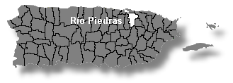 It is located to the south of the Santurce ward of San Juan. It borders west with Guaynabo, east with Carolina and Trujillo Alto and south with Aguas Buenas, Caguas and Gurabo.
Population:
332,344 (census 2000)
People are known as:
Riopedrenses
Río Piedras is also known as:
Cuidad Universitaria (University City)
Ciudad del Roble (Oak City)
Wards of the disappeared
municipality of Río Piedras:
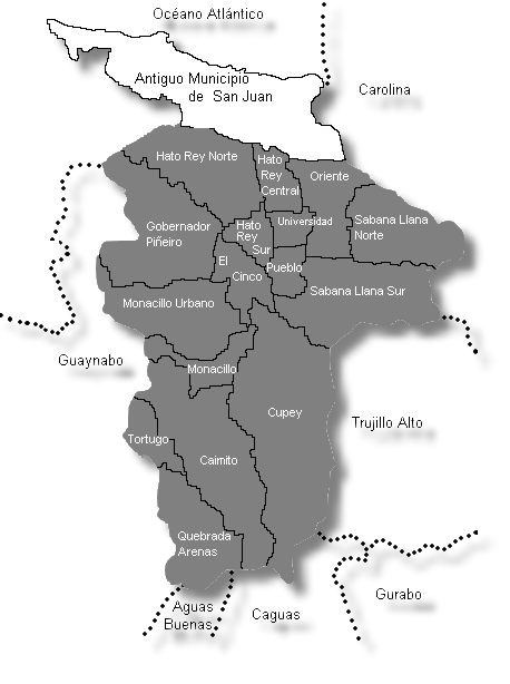
| Census 2000: Population by Wards – Río Piedras |
Habitants |
| Caimito | 20,832 |
| Cupey | 36,659 |
| El Cinco | 7,149 |
| Gobernador Piñero | 47,779 |
| Hato Rey Central | 20,867 |
| Hato Rey Norte | 16,461 |
| Hato Rey Sur | 10,868 |
| Monacillo | 12,425 |
| Monacillo Urbano | 29,309 |
| Oriente | 34,799 |
| Río Piedras (pueblo) | 9,391 |
| Quebrada Arenas | 2,753 |
| Sabana Llana Norte | 32,361 |
| Sabana Llana Sur | 43,839 |
| Tortugo | 4,351 |
| Universidad | 2,501 |
| Total | 332,344 |
Source: Censo 2000
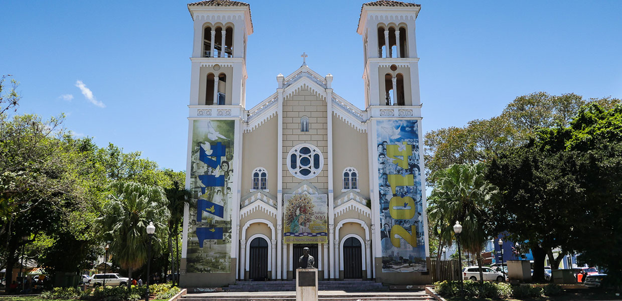
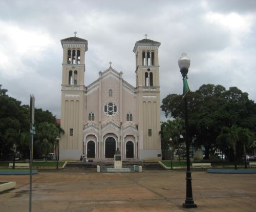
Patron:
Nuestra Señora del Pilar
Nuestra Señora del Pilar Parish
Plaza de Recreo Calle Georgetti Río Piedras, PR 00925
PO Box 21134 San Juan, PR 00928-1134
787 764 5088 / 787 763 3161
MISAS: Lunes a Viernes: 7:00 AM, Sábados: 7:00 AM y 6:00 PM
Domingo: 7:00 – 8:30 – 10:00 AM Templo Parroquial
Topography:
Its surface is almost totally level. It is located in the Northern Coastal Plains region and in the karst zone. The higher elevations are to the south, mainly in the Caimito and Cupey wards.
Hydrography:
It is watered by the Piedras river.
Economy:
Río Piedras is an important industrial, commercial and transport center. It also counts with the most important hospitals of the Island.
Average Salary:
$366.26 weekly (1998)
Flag:
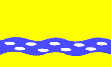 The flag of Río Piedras consists of a yellow background with a waved blue stripe. The blue stripe has small white stones that cross it. The blue stripe symbolizes the river and thecolor white symbolizes stones. The yellow background symbolizes the light of the sun, the progress and the future.
Coat Of Arms:
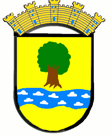 The coat of arms of Puerto Rico was first granted by the Spanish Crown in 1511, making it the oldest heraldic achievement still currently in use in the Americas. The territory was ceded by Spain to the United States in accordance to the peace treaty that ended the Spanish–American War in 1899, after which two interim arms were adopted briefly. A law was passed in 1905 that re-established the historical armorial bearings as the arms of the territory; after numerous investigations and amendments, the current version was adopted in 1976.
Hymn:
By Juan A Bonet
Soy vetusta chimenea
hoy truncada, muy de pié
cenizas y humo lancé
a Río Piedras del ayer.
Cuesta arriba, cuesta abajo
cargando de caña al buey
es leyenda del pasado
pues Vannina ya se fue.
Y en las cañas del batey
el dulce también se fue
con Río Piedras del ayer.
Places To Visit:
- University of Puerto Rico
- Botanical Garden
- Paseo de Diego
Distinguished Citizens:
- Lidio Cruz Monclova – Historian, writer, lawyer and teacher.