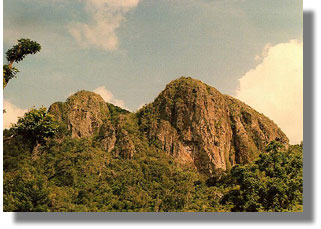
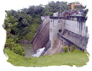
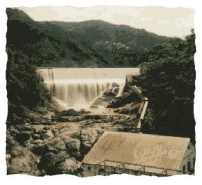
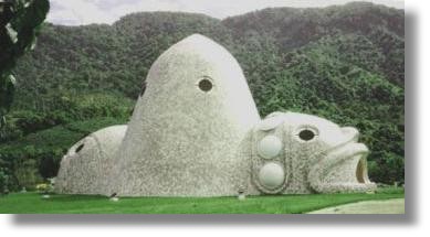
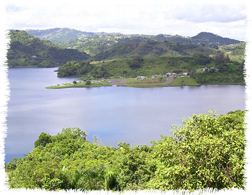
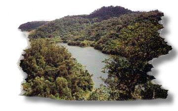
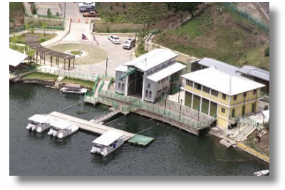
Adjuntas (ahd-HOON-tahs) is known as the “City of the Sleeping Giant”, the “Land of Lakes”, and the “Switzerland of the Americas”. The Cidra Festival takes place in Adjuntas each year in March. The patron saint festival is held around August 21, which is San Joaquín and Santa Ana Day. Adjuntas is part of the western region of the central mountain range, which gives it its mountainous topography. It is bordered on the north by Lares and Utuado; on the south by Yauco, Guayanilla and Peñuelas; on the east by Utuado and Ponce; and on the west by Lares and Yauco....
Aguas Buenas, Puerto Rico
Aguas Buenas, Puerto Rico City Of Clear Waters Aguas Buenas is known as the “City of Clear Waters” and the “Oasis of Puerto Rico”. The patron saint festival, in honor of Our Lady of Monserrate, is held in early September. This municipality is located in the center of the island and is part of the region known as the eastern humid mountains. It is about 259 meters above sea level. Aguas Buenas is bordered on the north by Bayamón, Guaynabo and Río Piedras; on the south by Cidra; to the east by Caguas and to the west by Comerío. The land is fertile, very appropriate for growing coffee and...
Aibonito, Puerto Rico
Aibonito, Puerto Rico City Of Flowers Aibonito (ei-bo-NEE-to) is known as “the garden of Puerto Rico” and the “city of flowers”. Aibonito is known for its poultry industry as well as its flowers and ornamental plants. The patron saint is Saint Joseph, although the patron saint’s festival is dedicated to St. James the Apostle, and held around July 25. Traditionally the festivities include low Mass, ringing of bells, fireworks, contests, lanterns and charanga music. The aiboniteños are proud of the natural beauty of their town, which makes it attractive for tourists, particularly the San Cristóbal Canyon, and the annual flower festival. Aibonito is located is located next to the...
Barranquitas, Puerto Rico
Barranquitas, Puerto Rico Home of Notable Citizens Barranquitas (bahr-rahn-KEE-tahs) is known as “the birthplace of founding fathers,” “the birthplace of craft fairs,” “the altar of the Nation,” and “Luis Muñoz Rivera’s town.” The name of the town comes from the clayey ditches cut into the earth by running water, gullies that are called barrancas, the diminutive of which is barranquitas. The patron saint is Saint Anthony of Padua, whose feast is celebrated on June 13. Another important festival is the crafts fair, for Barranquitas is an important crafts center, particularly for religious carvings, utensils, and musical instruments. Barranquitas is located in the eastern humid mountain region of the Central...
Cayey, Puerto Rico
Cayey, Puerto Rico Mist City Cayey (kei-YAI) is affectionately known as the City of the Mists, the City of the Little Bull, and the City of the Golden Coquí. Its Patron Saint is Our Lady of the Assumption, and the traditional Patron Saint Festivities are celebrated every August, bringing together residents and visitors in an atmosphere filled with music, culture, and devotion. Located in the heart of the Central Mountain Range, Cayey is distinguished by its cool climate and mountains that overlook Puerto Rico’s southern coast. It borders Cidra and Caguas to the north; Salinas and Guayama to the south; Caguas, San Lorenzo, and Patillas to the east; and...
Ciales, Puerto Rico
Ciales, Puerto Rico The Cojoba City Ciales (see-AH-les) is known as the “cojoba town,” “the land of coffee,” and “the town of the brave. The patron saint is Our Lady of the Rosary. Ciales is located on the northern side of the Central Mountain Range. It is bordered on the north by Arecibo, Florida and Manatí; on the south by Orocovis; on the east by Morovis and Orocovis; and on the west by Utuado and Jayuya. Three geographic regions converge in the municipality: the humid hills of the North; the humid mountains of the East; and the rainy mountains of the West. The moderately fertile soil is relatively deep....
Cidra, Puerto Rico
Cidra, Puerto Rico City of the Eternal Spring Cidra (SEE-drah) is known as the “City of Eternal Spring,” a name that reflects its cool and pleasant temperatures throughout much of the year. These climate conditions are directly related to its location in the mountainous region of central-eastern Puerto Rico. Its patron saint festivities, dedicated to Our Lady of Mount Carmel, are traditionally celebrated in July and represent one of the municipality’s most important cultural and religious events. Cidra borders Comerío and Aguas Buenas to the north, Cayey to the south, Aibonito to the west, and Caguas to the east. Its inland location has significantly influenced its historical, social, and...
Comerío, Puerto Rico
Comerío, Puerto Rico The Pearl of The Plata Comerío (ko-me-REE-o) is known as “the Pearl of La Plata” and “the town of the guabaleros”, the latter referring to a kind of spider called guabá. It was first known as Sabana del Palmar because of the many royal palms that grew on a plantation called El Palmar, the site where the town was founded. The town patron is Holy Christ the Healer, honored in the festival held around the 6th of August. Comerío is located in the central-eastern region of the island and is bordered by Naranjito and Bayamón to the north; Cidra and Barranquitas to the south; Aguas Buenas...
Jayuya, Puerto Rico
Jayuya, Puerto Rico Town of The Three Peaks Jayuya (hah-YOO-yah) is known as the "Town of The Three Peaks", “High Ground,” the “Town of the Tomato,” the “Town of the Three Peaks,” the “Indigenous Capital of Puerto Rico,” the “Overlook of Puerto Rico” and the “Artisan Mecca.” The autonomous municipality of Jayuya is located in the central region of Puerto Rico. It is bordered by Utuado and Ciales on the north, by Ponce, Juana Díaz and Orocovis on the south, by Ciales on the east and Utuado on the west. Jayuya is located in the highest elevations of the Central Mountain Range, site of the highest mountains in Puerto...
Lares, Puerto Rico
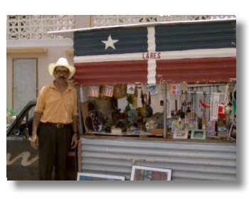
Lares, Puerto Rico The City Of The Revolt Lares (LAH-res) is known as the “the Town of The Grito”, “Capital of the Mountains” and the “Altar of the Fatherland”. Lares is located in the west central region of the island. It is bordered to the north by the town of Camuy, on the south by Yauco and Maricao, on the west by San Sebastián and Las Marías and on the east by Hatillo, Adjuntas and Utuado. Geographically, the municipality is part of the zone known as the central mountainous interior. Its highest elevations are found in the south, as the central mountain range extends through this area. Lares is...
Las Marías, Puerto Rico
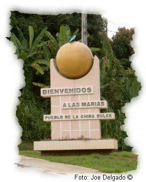
Las Marías, Puerto Rico Town Of The Sweet Orange Las Marías (lahs mah-REE-yahs) is known as the “pueblo de la china dulce” (Town of Sweet Oranges) and “ciudad de los cítricos” (Citrus Fruit City). The town’s patron saint is the Immaculate Conception of Mary. The town is set in the western region of Puerto Rico. This western Puerto Rican town is bounded by the municipalities of San Sebastián to the north, Maricao to the south, Lares to the east, and Mayagüez and Añasco to the west. Las Marías is part of the geographical region of the Cordillera Central mountain range. Well-known peaks include Las Marías, Plan Bonito, Valladares, Godén,...
Maricao, Puerto Rico
Maricao, Puerto Rico Town of Indian Settlements Maricao (mah-ree-KOU) is known as the “town of the Indian villages”, the “town of the Monte del Estado”, the “town of legend and romance” and the “land of coffee”. The patron saint is Saint John the Baptist. Maricao is located in the west central region of Puerto Rico. The town is located in the central mountain range, in the region of the humid mountains of the West. Maricao is bordered on the north by Mayagüez, Las Marías, and Lares; on the south by San Germán, Sabana Grande, and Yauco; on the east by Lares and Yauco; and on the west by Mayagüez...
Naranjito, Puerto Rico
Naranjito, Puerto Rico The Town of Colors Naranjito (nah-rahn-HEE-to) is known as “The Town of Colors” and the “Blackbird Town.” The patron saint’s festival is dedicated to Saint Michael the Archangel, and is held around September 29. The town also celebrates the 13th of June in honor of Saint Anthony of Padua. Naranjito is in the central eastern region of Puerto Rico. Naranjito is one of the municipalities in the northern hills region. It is bordered on the north by Toa Alta, on the south by Barranquitas and Comerío, on the east by Bayamón, and on the west by Corozal. This town has traditionally grown coffee, tobacco, and produce,...
Orocovis, Puerto Rico
Orocovis, Puerto Rico Heart of Puerto Rico Orocovis (o-ro-KO-vis) is known as the “Heart of Puerto Rico” and the “geographic center of Puerto Rico” because it is located precisely in the center of the island. The patron saint is San Juan Bautista. Orocovis is bordered on the north by the municipalities of Ciales, Morovis and Corozal, on the south by Juana Díaz, Villalba and Coamo, on the east by the municipalities of Barranquitas and Corozal and on the west by Ciales. Geographically, the municipality is part of the region known as the Cayey Range in the central mountain range, which is a mountainous zone. The municipality’s highest elevations are...
Utuado, Puerto Rico
Utuado, Puerto Rico City of the Viví Utuado (oo-too-AH-do) is known as the “City of the Viví” and the town of “The Highlanders”. The municipality’s patron saint festival is held in late September in honor of San Miguel Arcángel. Other cultural festivals include the Otoao festival in December and the Angeles neighborhood festival in March. Utuado is located in the mountainous central part of the island. It is bordered to the north by the municipalities of Hatillo and Arecibo, to the south by Adjuntas, Ponce and Jayuya, to the east by Ciales and Jayuya and to the west by Lares. Geographically, it is part of the central mountainous interior...

